Supplier Methodology Overview
Supporting EUDR compliance remotely, accurately, and at low-cost.
First of all, why does this matter?
From 30 December 2025, all companies selling certain goods into the EU must prove that their supply chains are deforestation-free.
This means buyers must know exactly where their products come from, and show regulators that land has not been cleared after the 2020 cut-off date.
Suppliers play a critical role: your data and cooperation make compliance possible.

As a supplier, what’s in it for you?
✔ Easier or maintained access to EU markets.
✔ Fewer disputes or delays with customers.
✔ Stronger trust and long-term buyer relationships.
How OpenAtlas helps:
Think of OpenAtlas as the “X-ray” for land use: invisible to the eye, but making sure what’s beneath the surface is safe and transparent. With this process, your products carry the assurance regulators need and the confidence buyers want.
-
You (or your buyer) share a GPS point or simple map outline of your farm, plot, or sourcing area.
This is the only “technical” step we need from you, no special equipment or expertise required.
-
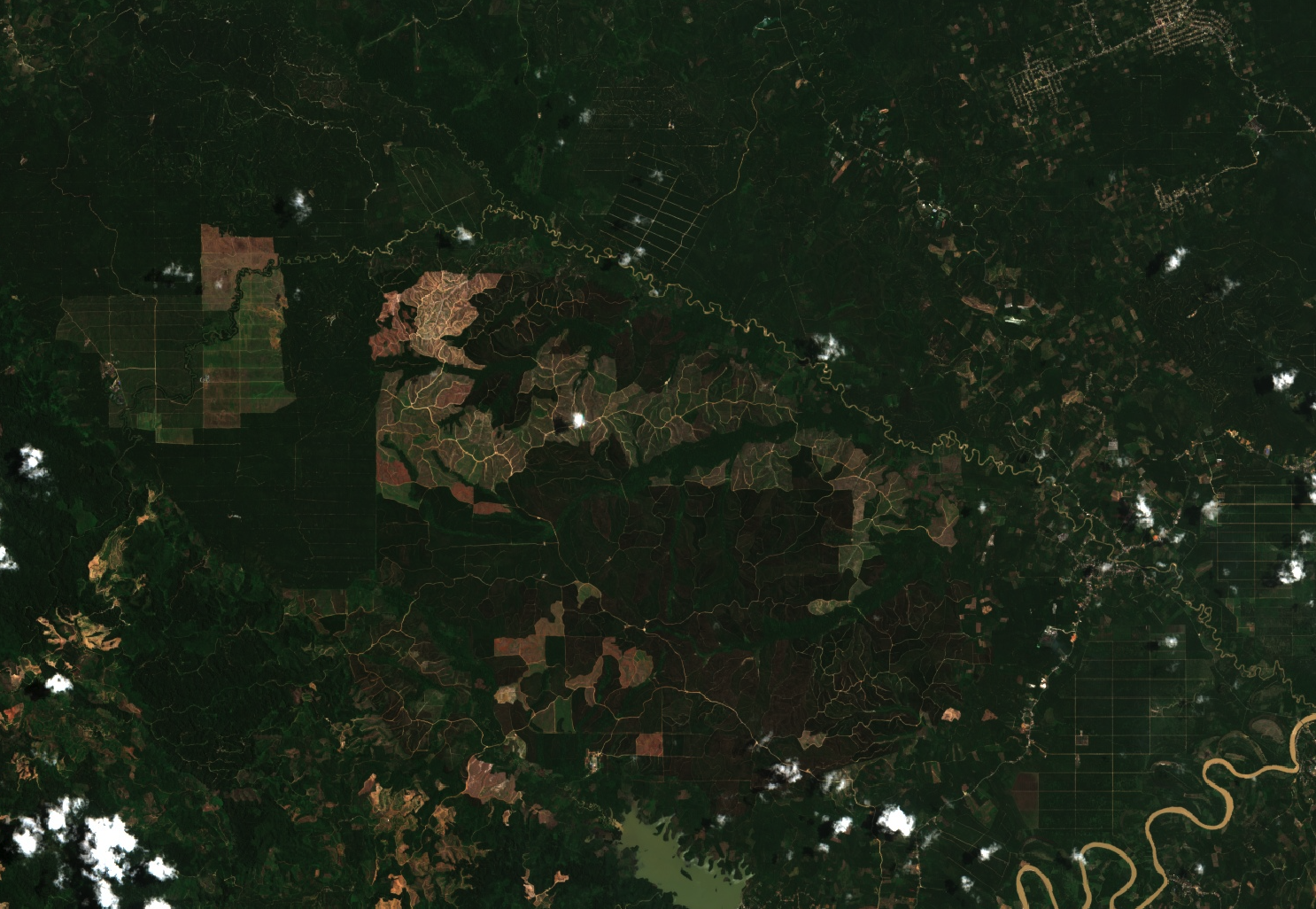
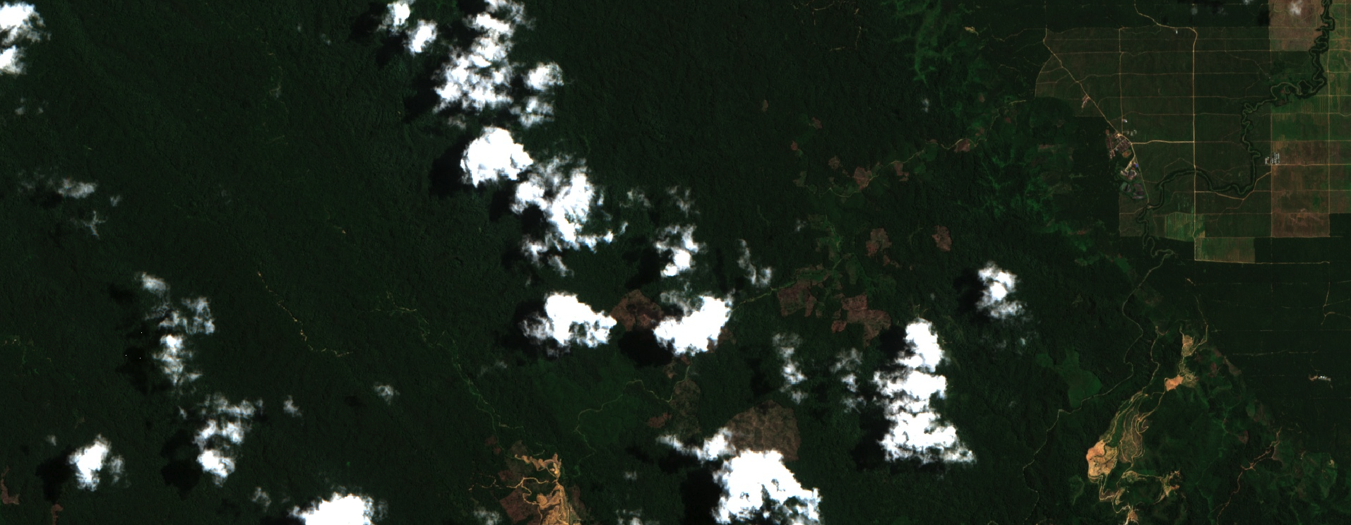
Our system uses the European Sentinel-2 satellites, which circle the earth every few days and take high-quality images of farmland and forests.
We look back to the 2020 legal cut-off date set by the EU and check whether the land was forested then.
We then review every image since 2020 to see if trees have been cleared. This allows us to detect real deforestation rather than seasonal changes or normal harvesting cycles.
-
In addition to deforestation, the EU requires that land is not inside areas of special protection.
We cross-check the farm boundaries against global databases of Indigenous lands, national parks, and conservation areas.
This ensures buyers (and regulators) can be confident that your products are legally sourced.
-
We combine all of this into a simple statement for your buyer:
Deforestation-free: no issues detected.
Needs verification: something looks unclear — e.g. cloud cover blocked a satellite image, or the plot borders need checking.
Your buyer receives a compliance-ready document they can include in their due diligence submission to the EU.
1.Provide accurate farm boundaries (a GPS point or polygon is enough)
If your farm doesn’t change, this is needed only once!
2.Confirm harvest date(s) of the product.
3.Respond if follow-up questions are raised.
That’s it.
The rest of the work is done by us.
What do you need to do?
Summary:
1. OpenAtlas makes EUDR compliance simple, reliable, and low-cost.
2. Your cooperation ensures your products keep flowing into valuable EU markets.
3. Together, we build transparent, sustainable supply chains.